568k
568k  233k
233k  41k
41k  Subscribe
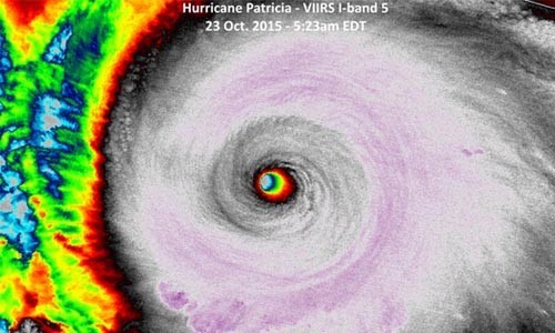
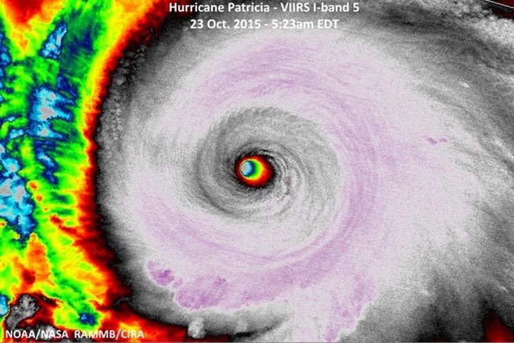
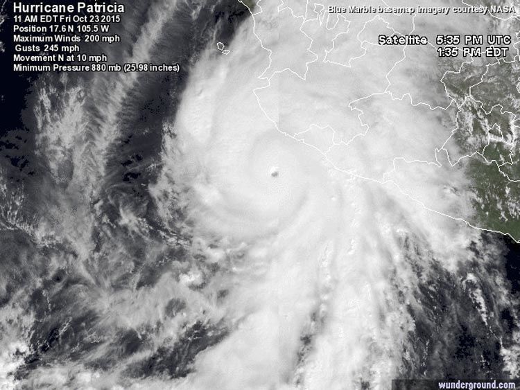
Stunning, historic, mind-boggling and catastrophic: that sums up Hurricane Patricia, which intensified to an incredible-strength Category 5 storm with 200 mph winds overnight.
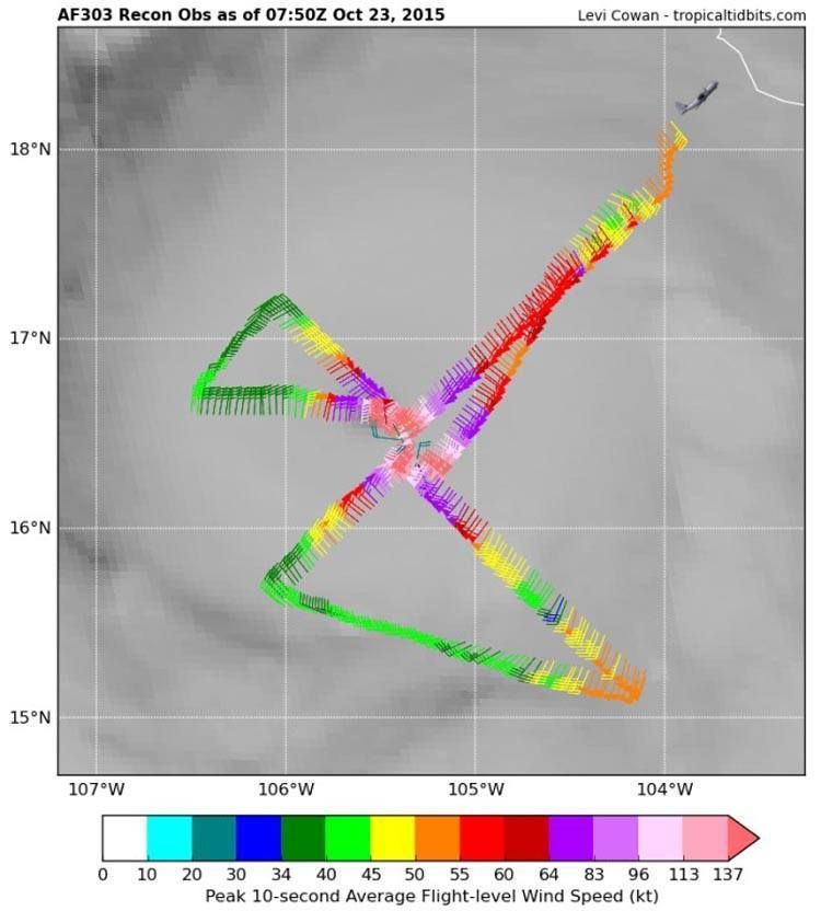
At 2:46 a.m. EDT Oct. 23, an Air Force hurricane hunter aircraft measured a central pressure of 880 mb in Patricia, making it the most intense hurricane ever observed in the Western Hemisphere. The aircraft measured surface winds of 200 mph, which are the highest reliably-measured surface winds on record for a tropical cyclone, anywhere on the Earth. The previous strongest Eastern Pacific hurricane was Hurricane Linda of 1997, with a pressure of 902 mb (estimated from satellite imagery). The strongest Atlantic hurricane on record was Hurricane Wilma of 2005, with an 882 mb central pressure. Patricia does not beat the record-lowest pressure in the Western Pacific, though, which is held by Super Typhoon Tip of 1979: 870 mb.
Patricia the Fastest-Intensifying Western Hemisphere Hurricane on Record
Patricia’s central pressure dropped an astonishing 100 mb in 24 hours, making it the fastest-intensifying hurricane ever observed in the Western Hemisphere. Patricia’s pressure at 5 a.m. EDT on Thursday, Oct. 22, was 980 mb, and was 880 mb at 5 a.m. EDT on Friday. The previous record was a drop of 97 mb in 24 hours for Hurricane Wilma of 2005 (between 1200 UTC 18 October – 1200 UTC 19 October), according to the official National Hurricane Center (NHC) report for the storm. Patricia’s intensification rate was very close to the WMO-recognized world record for fasting-intensifying tropical cyclone: 100 millibars in just under 24 hours by Super Typhoon Forrest in the Northwest Pacific in 1983.
Patricia is estimated to have intensified 85 knots (100 mph) in 24 hours, from a tropical storm to a Category 5 hurricane. In the Eastern Pacific, Hurricane Linda of 1997 is the only storm on record to have intensified at this rate. The Atlantic’s record holder for largest wind increase in 24 hours is held by Hurricane Wilma of 2005, which intensified from a 60-knot tropical storm to a 150-knot Category 5 hurricane—an increase of 90 knots (105 mph). Air Force reconnaissance observations indicated that the eye of Wilma contracted to a diameter of 2 n mi during this time; this is the smallest eye known to NHC staff. Patricia’s eye diameter was 8 miles at it’s peak strength.